EDNA Derived Watersheds for Major Named Rivers
|
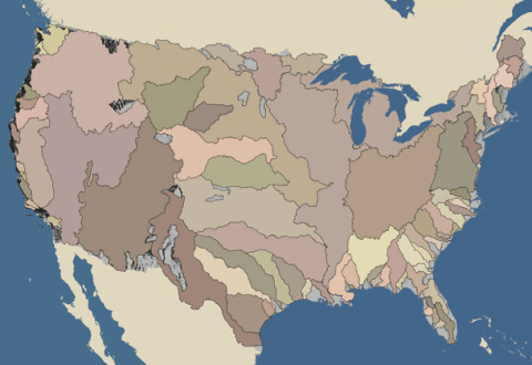
EDNA-derived watersheds and watershed characteristics are now available for viewing in KML format! Position the mouse over a watershed name to identifiy the location, or click on the name to view the watershed in a KML viewer such as Google Earth. To see the entire set of available EDNA watersheds in KML format, click on the map. Please note: some of the files may take a few moments to load. The files range in size from 2 - 18MB. If a KML viewer is not installed, the EDNA-derived watersheds and their characteristics can also be viewed in a standard Web browser (HTML). View the HTML version. |
|
New! Watershed data for the Gavin's Point Dam is now available. Instructions To view these data, a KML viewer such as Google Earth must be installed. For a free Google Earth download, click the link below. In Google Earth, click on the placemark to view watershed characteristics. Expand the legend under "Places" to view available watershed layers.
|